• Back

Cities Gone Wild:
Understanding Urban Homesteads Through Remote Sensing

Remote Sesnsing Study sited in Wuhan, China
Funded Fellowship Research at Cornell University AAP
+ Remote Sesnsing Research Project at University of Oxford


Presented at the 2023 International Geoscience and Remote Sensing Symposium

As the world moves rapidly towards urbanisation, the locus of urban growth is shifting away from the global north towards developing countries in Asia and Africa. This shift in geography, culture, social and political systems, in combination with the unprecedented speed of the urbanisation process occurring within these regions, have in many cases created a different urban reality than the Eurocentric vision of modernity. This study analyses the temporal and spatial dynamics of one such divergence found in China’s rapidly urbanising landscape - a phenomenon called chengshi kaihuang (urban homesteading). A practice of informal vegetable gardening that emerges from urban wastelands, urban homesteading has been quietly ruralising China’s newly constructed urban landscape. As such, it challenges both the Eurocentric separation between the rural and the urban, and the assumption of the passive and powerless Chinese citizen within understandings of contemporary China. Taking Wuhan as the study area, this paper leverages Sentinel-2 and Landsat-7,8 data in conjunction with 10m resolution land use/land cover products from the Finer Resolution Observation and Monitoring of Global Land Cover (FROM-GLC), European Space Agency (ESA), and Environmental Systems Research Institute (ESRI), to study the spatial, temporal, and ecological dynamics of urban homesteading within the urban environment. Through supervised land cover classification, the study shows that urban homesteading is a significant urban phenomenon that makes up approximately 5% of the land area of Wuhan’s urban centre.
  • Ruralizing Urbanization
  • Breaking into Silence
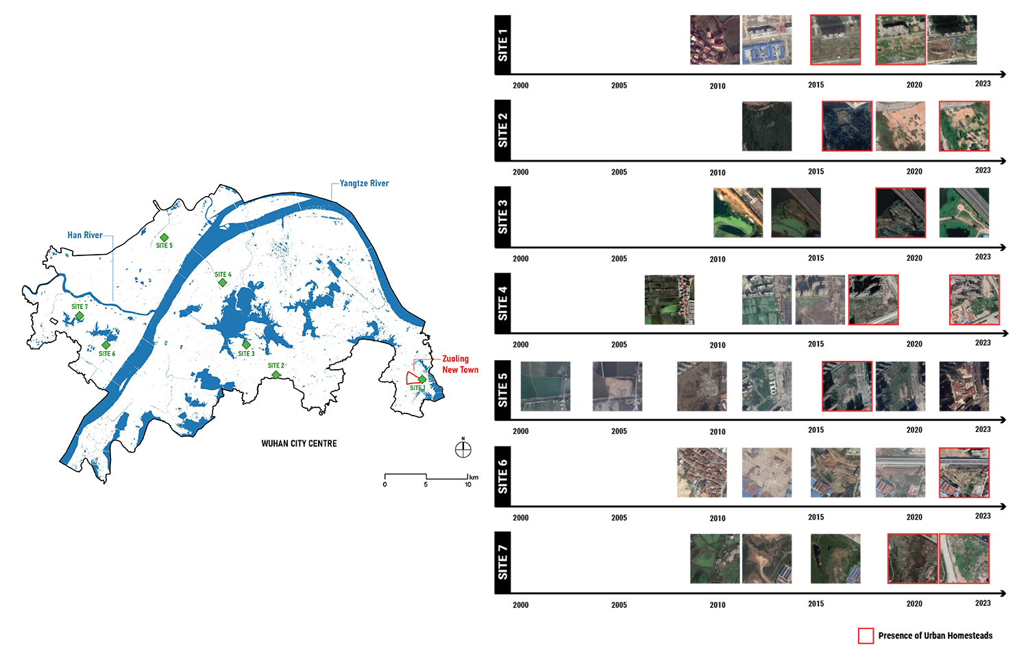
Sampling Sites for Classifier Training
Supervised Machine Learning Land Cover Classification (LCC)

Training AI to recognize land cover types through analysis of remote sensing hyperspectral data

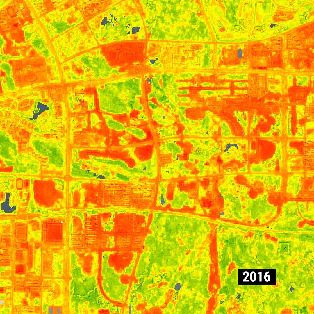
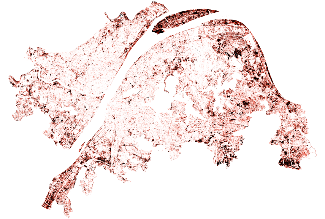
Mapping of demolition (orange)
vs landscaped (green) areas in Wuhan 2017-2021
Land Use Volatility 2017-2021

The image above maps the occurance of demolished land every year from 2017-2021, HOVER OVER THE TITLE to see the map of overall land use volatility during this period.

The key to the successful classification of urban homesteads within this study was the identification of the volatile spatiotemporal character of urban homesteads. The distinguishing characteristic of urban homesteads in comparison to parks or rural fields is its association with lands that have experienced rapid and frequent changes to their land cover through construction and demolition. This volatility is both a precurser and a consequence of urban homesteading - an unstable pattern of land ownership/use creates justification for homestead cultivation, and the resulting homesteadeds are frequently destroyed by developers/authorities.
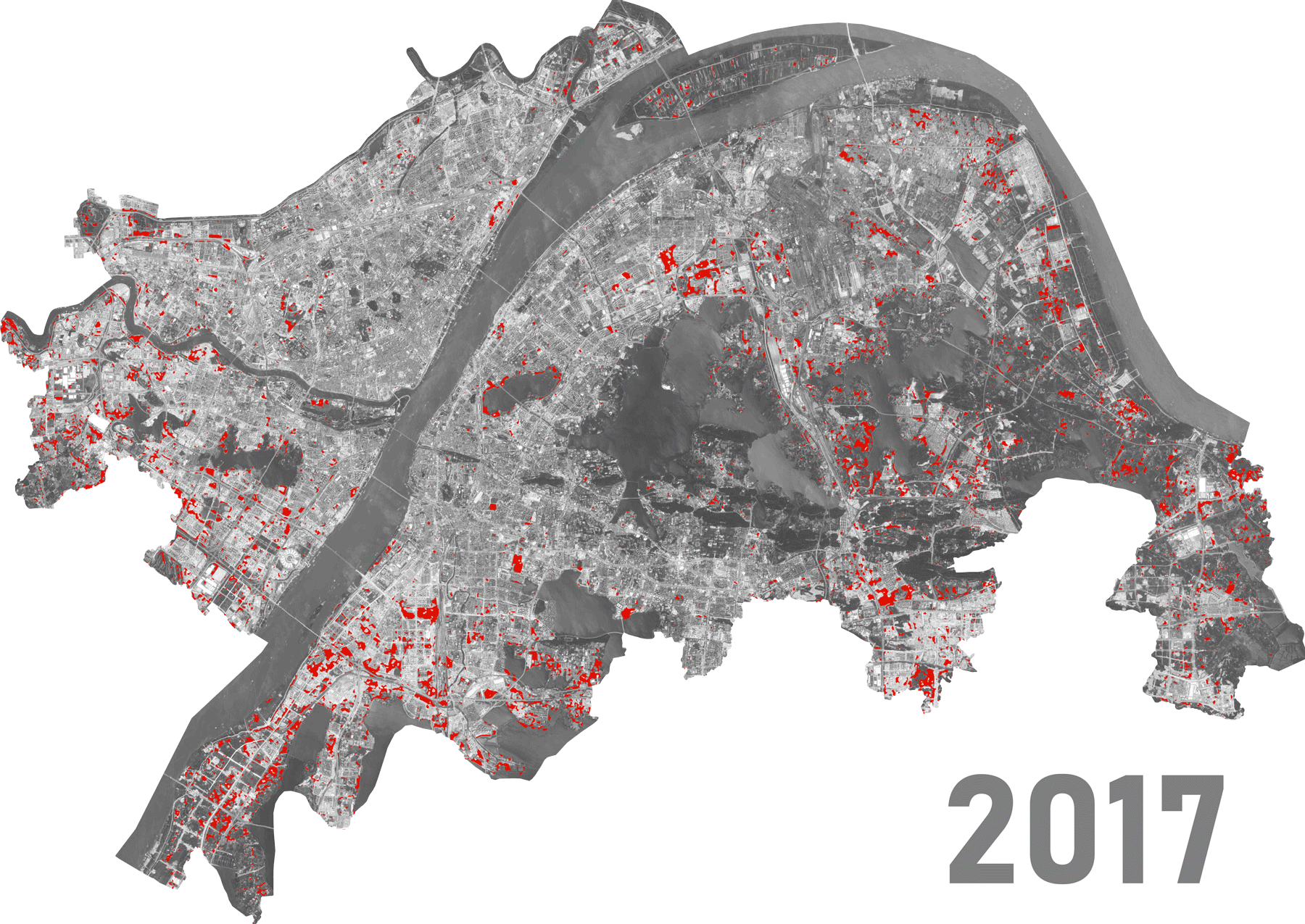
Urban homesteading sites identified through supervised machine learning land cover classification.